CPP41721 Certificate IV in Surveying and Spatial Information Services
CPP41721 · Start your career pathway in surveying.
- Qualification
- Certificate IV
- Next start
- 4 November 2026
- Duration
- 31 weeks, including 1 week vacation
- Units
- 15 units
- CRICOS course code
- 115263K
Course overview
This 31-week nationally recognised qualification is delivered by SRDITA as a Registered Training Organisation, in line with the relevant national training package requirements and ASQA standards.
The course is designed for students who want to gain practical skills for work in land surveying, construction surveying and spatial information services. Students learn how to collect and record survey data, read plans and maps, carry out measurements, use surveying instruments, and support field and office-based surveying tasks.
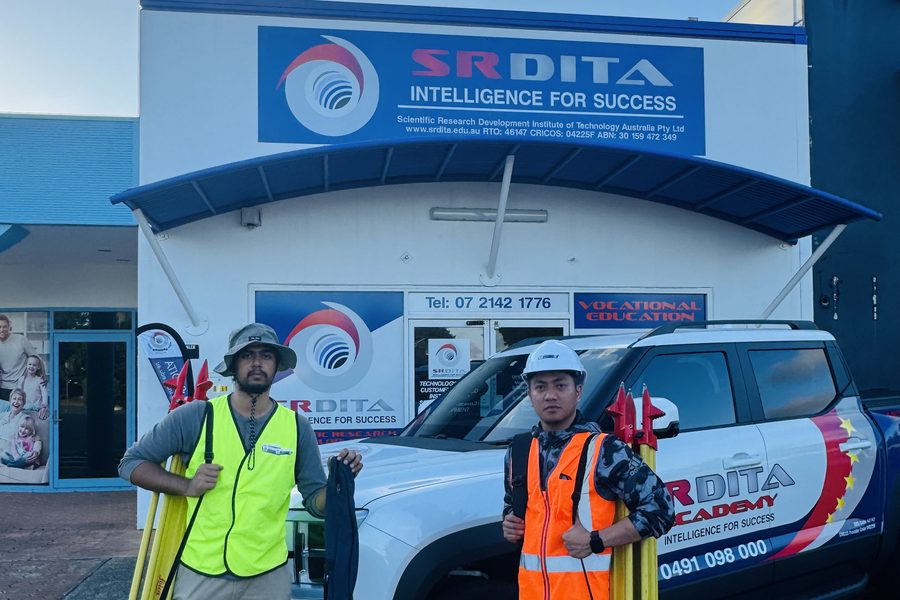
Fieldwork is an important part of the course. Students gain practical experience in workplace-style activities and learn how surveying work is carried out safely and accurately under supervision.
The course is suitable for students who are new to the industry, as well as those wanting to build stronger technical skills for surveying support roles.
Successful completion may support entry-level employment in surveying and spatial information services and provide a pathway to further study, including the Diploma of Surveying and Advanced Diploma of Surveying.
Delivery modes
Face-to-face
Training is primarily delivered at the SRDITA Meadowbrook campus through classroom-based learning and practical field activities. Online learning activities and training and assessment support may also be provided where appropriate, in accordance with the course delivery and assessment requirements.
Blended learning
The theory component is delivered through self-paced online learning resources and/or scheduled live online classes, with ongoing access to support from qualified trainers and assessors. Students must attend the mandatory face-to-face practical training and assessment block at the SRDITA Meadowbrook campus to develop and demonstrate the practical skills required by the course.
Course duration
The course duration is the same for both Face-to-Face and Blended Learning delivery modes. Blended Learning provides flexibility in how the theory component is undertaken; it does not reduce the course duration or the training and assessment requirements. All students must complete the required training and assessment activities and demonstrate competency in all required units of competency.
Eligibility for blended learning
Blended Learning is available only for approved non-CRICOS delivery and eligible students. Australian Citizens, Australian Permanent Residents and eligible temporary visa holders who are lawfully entitled to undertake the course in Australia may be considered for this delivery mode. International students studying in Australia on a Student visa (Subclass 500) must enrol in the applicable CRICOS-registered course and undertake the approved CRICOS delivery mode.
Important
Availability of a delivery mode is subject to the requirements of the specific course, the student's eligibility and SRDITA's approved delivery arrangements. Students should confirm their applicable delivery mode with SRDITA before enrolment.
Qualification description
This qualification reflects the role of entry-level technicians who work under supervision to support surveying and spatial information services teams.
Students develop skills that may be applied across a range of industry areas, including town planning, civil construction, mining, engineering, health, agriculture and defence.
Surveying technicians may assist with field and office tasks using surveying tools and equipment, including total stations and global navigation satellite systems. Spatial information services technicians may use geospatial technologies and specialised software to collect, manage and process spatial data.
Cadastral surveying work must be carried out under the supervision of a registered surveyor. Students should refer to the relevant state or territory regulatory authority for specific requirements.
At the time of publication, there are no licensing, legislative or certification requirements attached to this qualification. This qualification may also be suitable as part of an Australian traineeship pathway.
Possible career pathways
This qualification may support employment in supervised surveying and spatial information services roles, including Surveying Technician, Survey Assistant, Field Survey Technician, Spatial Information Services Technician, GIS Assistant, Mapping Assistant and Geospatial Data Assistant.
Entry requirements
English language, literacy and numeracy
- At a minimum, learners must demonstrate numeracy and English language skills equivalent to Australian Year 10. This includes the ability to read, write, speak and understand English sufficiently to participate in training, complete assessments and achieve the requirements of the qualification.
- International applicants must provide evidence of English language proficiency equivalent to IELTS Academic 6.0, with no individual band score below 6.0, or an equivalent recognised English language test result accepted by SRDITA.
Learners are additionally required to
- Complete the SRDITA assessment for LLN Level 4 and digital skills
- Have access to a computer and the internet
- Possess computer skills to navigate websites and complete basic word-processing tasks
When you study with SRDITA, we want to see you succeed. Our general entry requirements help ensure you have the necessary existing knowledge and skills to complete your chosen qualification. You will need to provide evidence that you meet the requirements outlined in this section.
Fieldwork requirement
Learners are required to supply the following:
- Closed-in shoes suitable for working in parks and gardens
- Loose-fitting long-sleeve shirt and pants for sun protection
- Wide-brimmed hat for sun protection
Pathways and requisites
After completing the CPP41721 Certificate IV in Surveying and Spatial Information Services (Surveying), learners may choose to complete the CPP50221 Diploma of Spatial Information Services.
Pre-requisites
There are no prerequisites for this qualification.
Co-requisites
There are no co-requisites for this qualification.
Units of competency
SRDITA delivers 15 units for the Certificate IV in Surveying and Spatial Information Services.