INSTRUCTORS:
Tharushika Balasooriya
Teacher/ Surveyor - BSc (Hons) Surveying SciencesDr. Nelson Wijenayake
(PhD, MSc, BSc, TAE40122) Trainer & Assessor – SurveyingAddress
8/11 Logandowns Drive, Meadowbrook, QLD 4131 View mapApply for Enrolment
Initial Application Processing Fee: $50.00 (Non-Refundable Application Fee)
Amenity Fee: $300.00
For Domestic students: $ 10,493.00
Method of Payment: Monthly Instalments – Fee Schedule (Pay-As-You-Go)
Fee Protection
SRDITA ensures student fee security by limiting domestic student payments to no more than $1,500 in advance. All international student prepaid tuition fees are safeguarded through the Australian Government’s Tuition Protection Service (TPS).
Delivery Modes
This course is delivered through a blended learning model, comprising face-to-face classes on Mondays and Wednesdays and online classes on Tuesdays. Additional online learning, training, and assessment activities may be scheduled as required to meet the nominal hours of the qualification.
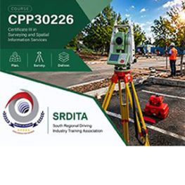
Certificate III in Surveying and Spatial Information Services
Take the next step into the surveying and spatial information industry with the Certificate III in Surveying and Spatial Information Services.
This 32-week vocational qualification is designed for students who want to build practical skills for field and office-based surveying support work. Students develop foundation knowledge in data collection, basic measurements, set-out support, spatial information handling, safe work practices and industry procedures.
The course is suitable for people starting a career in surveying or spatial services, as well as those wanting to strengthen their technical skills for supervised industry work.
SRDITA delivers this qualification in line with national training package requirements and applicable ASQA standards, with a focus on practical learning, workplace readiness and industry-relevant skills.
Successful completion may support entry into surveying and spatial information support roles and provide a pathway to further study, including Certificate IV and Diploma qualifications.
Qualification Description
This qualification reflects the role of surveying or spatial information services assistants who work under supervision to support a surveying or spatial information services team. They perform a range of duties from collecting basic spatial data and providing field support services, to simple drafting and map production.
Surveying and spatial information skills are applied in a range of industry contexts, including town planning, civil construction, mining, engineering, health, agriculture and defence.
Cadastral surveying must be undertaken under the supervision of a registered surveyor. Relevant state and territory regulatory authorities should be consulted to confirm those requirements.
This qualification is suitable for an Australian traineeship pathway.
Possible Career Pathways
This qualification may support entry-level employment in supervised surveying and spatial information services roles, including survey assisting, field support, data collection, mapping support, GIS assistance and spatial data handling.
Entry requirements
Entry points to undertake the CPP30226 Certificate III in Surveying and Spatial Information Services are:
- This qualification has no entry requirements.
At a minimum, SRDITA requires that the Learner can:
- Entry to this qualification requires learners to demonstrate numeracy skills and English language reading, writing and oral communication skills equivalent to Australian Year 8 level.
Learners are additionally required to:
- Have access to a computer and the internet
- Possess computer skills to navigate websites and complete basic word-processing tasks
- Complete SRDITA assessment of LLN Level 3 and Digital Skills
Fieldwork Requirement
Learners are required to supply the following:
- Closed-in shoes suitable for working in parks and gardens
- Loose-fitting long-sleeve shirt and pants for sun protection
- Wide-brimmed hat for sun protection
Pathways
Learners receive advice on employment and training pathways/options throughout the program’s delivery. Each learner has an individual discussion with the Careers Department provided by SRDITA. This course will give learners access to further education at the degree level and prepare them for how the training sector works. Employment in middle-level positions within the surveying sector will also be achievable.
This qualification is suitable for an Australian apprenticeship pathway.
Pre-requisites
This qualification has no formal prerequisite requirements.
List of Units
SRDITA delivers 11 units for the Certificate III in Surveying and Spatial Information Services.
Related Course


Courses List

CPP60121 Advanced Diploma of Surveying
February 1, 2027
